Google Maps dispatches street view vehicles to Erbil
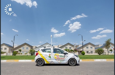
The company has sent six special vehicles to the capital city of the Kurdistan Region for several days in an effort to capture the neighborhoods of Erbil for viewing on Google Maps and Earth.
The cameras attached to the cars are directly connected with satellites and are photographing the city from 12 different angles, driving slowly down streets at 10 to 20 kilometers per hour.
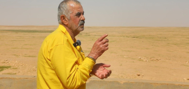
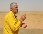
Ahmed Mohammad Mustafa, Google's trusted administrator in the Kurdistan Region and Iraq, works at the company’s main headquarters in Erbil.
He told Rudaw, “I have been working with Google in Erbil for a year and a half. I worked for Google for four years in Italy [before this]. I came back for this project, to put Erbil’s neighborhoods on the world map.”
The project is being conducted in coordination with the Hemn group in Erbil. “The design is being developed by Google and we [Google and Hemn] are implementing it here," Ahmed added.
"We have finished working on the 100-meter and 120-meter ring roads, as well as in the Italian villages one and two," he said, adding that "after Eid al-Fitr, we will also work on the 30-meter and 40-meter ring roads.”
The Google administrator says when the project is complete, it will be one of Google’s most visually interesting maps due to Erbil’s spider-like urban shape.
The project will take a year, according to Ahmed, who added that the head of Erbil’s municipality is providing them with names of the neighborhoods and locations in the city.
Rudaw